Aerial LiDAR Mapping
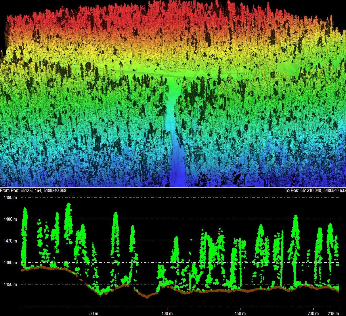
LiDAR (Light Detection and Ranging) is one of the most powerful tools in modern surveying. Our drone-mounted LiDAR sensors emit thousands of laser pulses per second, creating incredibly dense 3D point clouds that capture every detail of the terrain below — even under dense vegetation and forest canopy.
Unlike traditional photogrammetry, LiDAR penetrates tree cover to map the bare earth beneath. This makes it the go-to solution for forested sites, steep terrain, riparian areas, and anywhere ground visibility is limited. We use AI-assisted classification to process raw point cloud data into clean, georeferenced deliverables ready for your engineering or GIS workflows.
- High-density point clouds (hundreds of points per m²)
- Bare-earth models through vegetation and canopy
- RTK/PPK positioning for survey-grade accuracy
- Deliverables in LAS, LAZ, GeoTIFF, DWG, and more
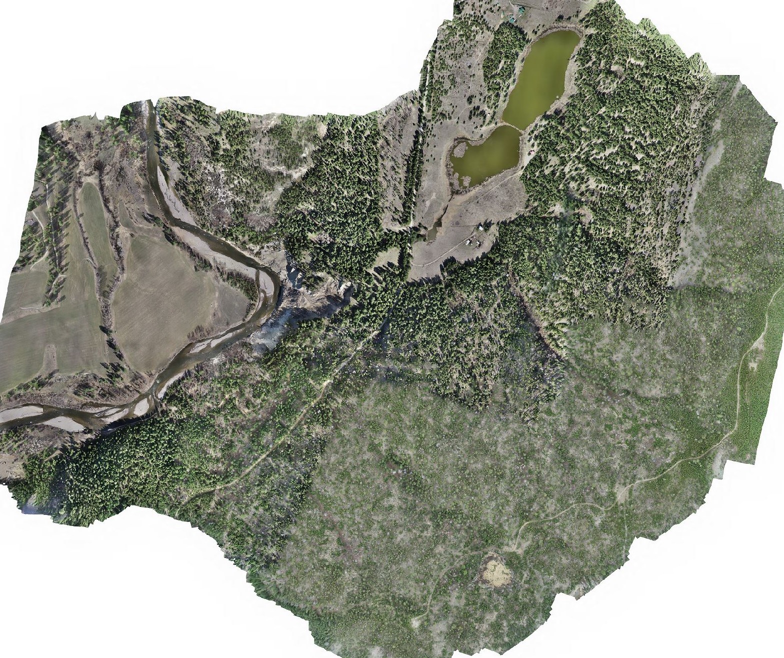
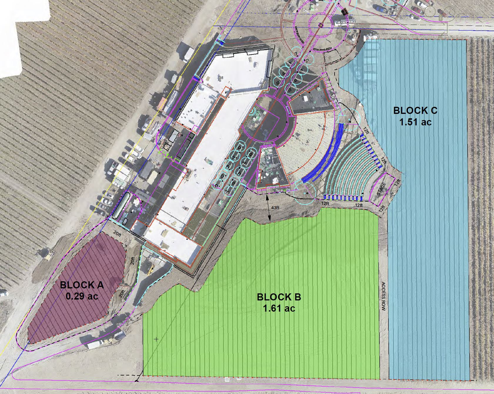
Orthophoto Mosaics
An orthophoto mosaic is a geometrically corrected aerial image that can be used as a map. We capture hundreds of overlapping high-resolution photographs from our drones, then process them into a single, seamless, georeferenced image of your entire site. Every pixel is tied to real-world coordinates, so you can measure distances, areas, and features directly from the image.
Orthophotos are invaluable for site documentation, baseline surveys, progress monitoring, and client presentations. They provide a photorealistic bird's-eye view of your project at centimetre-level resolution — far more detailed than satellite imagery and updated on your schedule.
- Sub-centimetre ground sample distance (GSD)
- Fully georeferenced and measurable imagery
- Progress tracking with repeat surveys over time
- GeoTIFF, ECW, MBTiles, and many other formats to suit your workflow
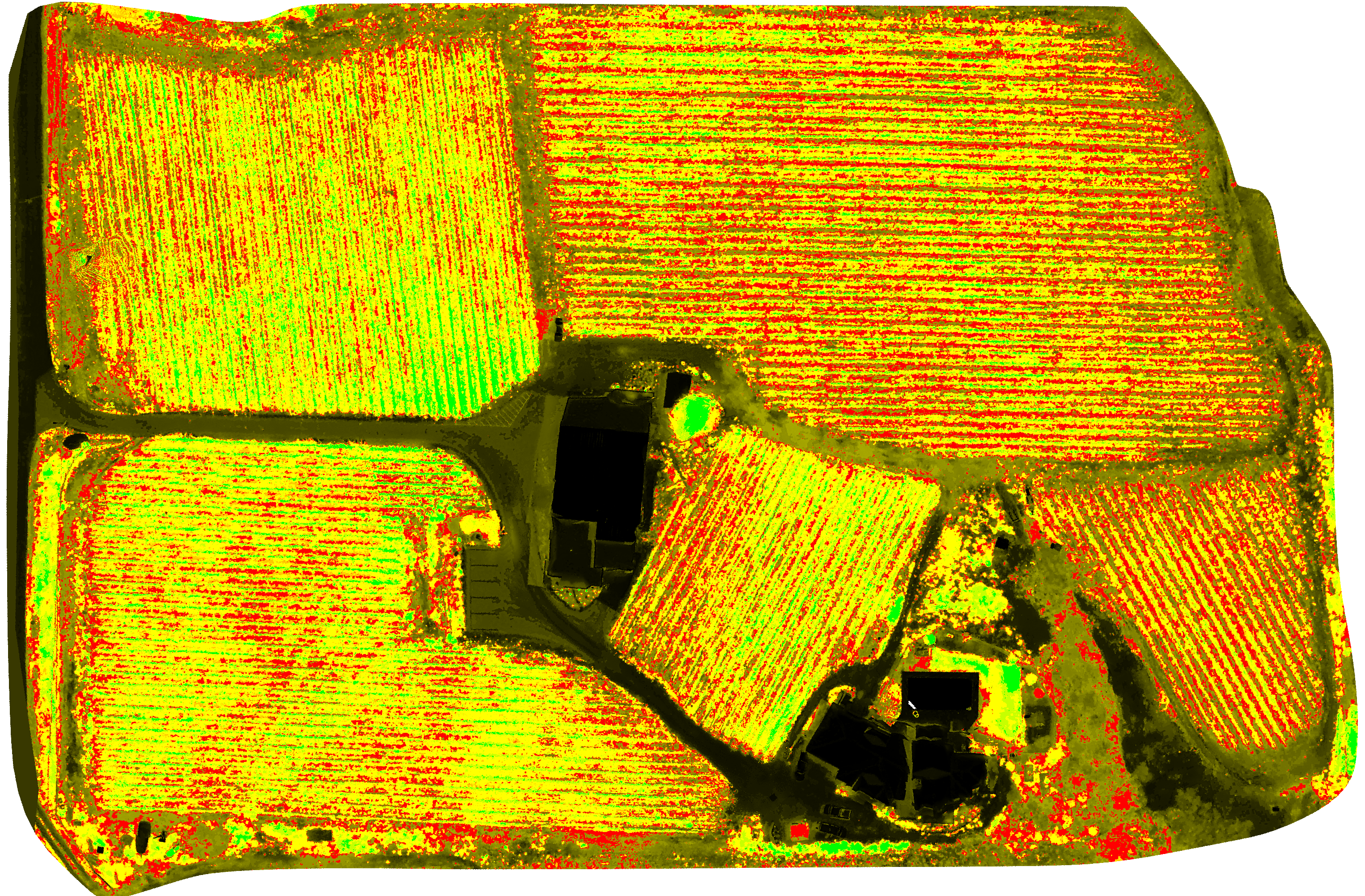
Multispectral Imaging
Our multispectral sensors capture light beyond the visible spectrum, revealing information about plant health that the human eye simply cannot see. By analysing specific wavelength bands, we generate vegetation indices like NDVI (Normalized Difference Vegetation Index), NDRE (Normalized Difference Red Edge), and CWSI (Crop Water Stress Index) that quantify crop vigour, nutrient uptake, and water stress.
For vineyards, orchards, and farms across the Okanagan and BC, this data enables precision agriculture — targeted irrigation, variable-rate fertilization, early disease detection, and optimized harvest timing. Identify problem areas weeks before symptoms are visible to the eye and take corrective action before yield is lost.
- NDVI, NDRE, CWSI, and custom vegetation indices
- Early stress and disease detection before visual symptoms
- Zone mapping for variable-rate application
- Seasonal monitoring with repeat flight campaigns
GIS & CAD Services
Collecting aerial data is only half the equation — the real value comes from turning it into deliverables that integrate seamlessly into your existing workflows. Our GIS and CAD services leverage AI-powered automation and expert analysis to bridge the gap between raw drone data and the tools your team uses every day, whether that's ArcGIS, QGIS, AutoCAD, Civil 3D, or any other industry platform.
We deliver georeferenced shapefiles, DWG drawings, GeoTIFFs, KML overlays, and custom map products tailored to your project requirements. Need contour lines at specific intervals? Feature extraction for utilities? Annotation layers for a site plan? We build exactly what you need so your team can get to work immediately.
- Shapefiles, DWG, DXF, GeoTIFF, KML/KMZ
- Contour generation at custom intervals
- Feature extraction and annotation layers
- Compatible with ArcGIS, QGIS, AutoCAD, Civil 3D
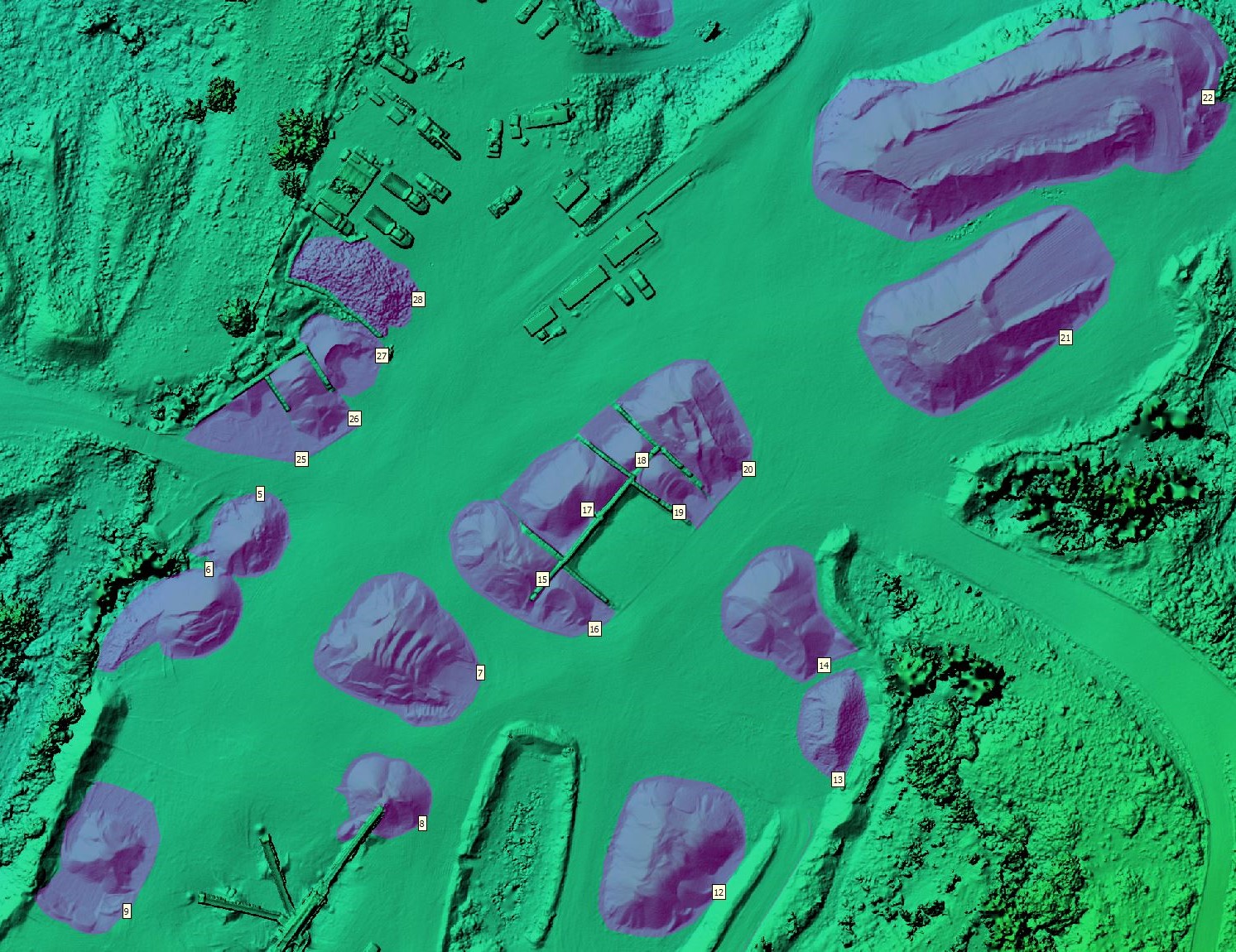
Volumetric Measurements
Accurate volume calculations are critical for inventory management, regulatory compliance, and billing verification. Our drone surveys capture the complete 3D surface of stockpiles, excavations, and fill areas, enabling precise volume measurements that are faster and more detailed than traditional GPS point surveys.
Whether you need monthly stockpile inventories at a gravel pit, cut/fill calculations on a construction site, or waste volume tracking at a landfill, our volumetric surveys deliver repeatable, auditable results. Compare volumes across time to track material movement and verify quantities with confidence.
- Stockpile, cut/fill, and excavation volumes
- Change detection between survey dates
- Faster and more accurate than GPS point surveys
- Detailed reports with visual breakdowns
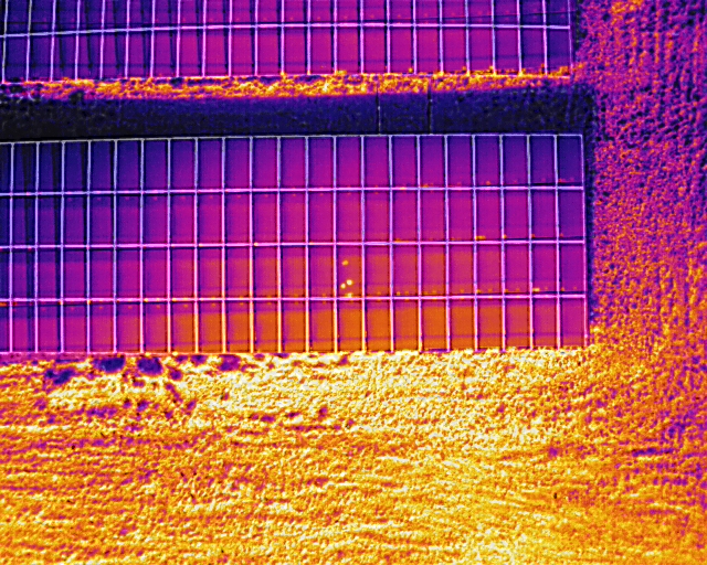
Thermal Inspection & Mapping
Our radiometric thermal cameras capture infrared imagery that reveals temperature variations invisible to the naked eye. From rooftops to solar arrays, thermal imaging is a fast, non-contact method for identifying issues that would otherwise require expensive manual inspection or remain undetected until failure.
Thermal drone surveys are especially effective for solar panel inspection (hotspot and bypass diode detection), building envelope analysis (insulation gaps, moisture intrusion, air leaks), electrical infrastructure assessment, and environmental monitoring such as detecting thermal discharge into waterways.
- Solar panel hotspot and defect detection
- Building envelope and insulation analysis
- Electrical infrastructure assessment
- Radiometric data with calibrated temperature values
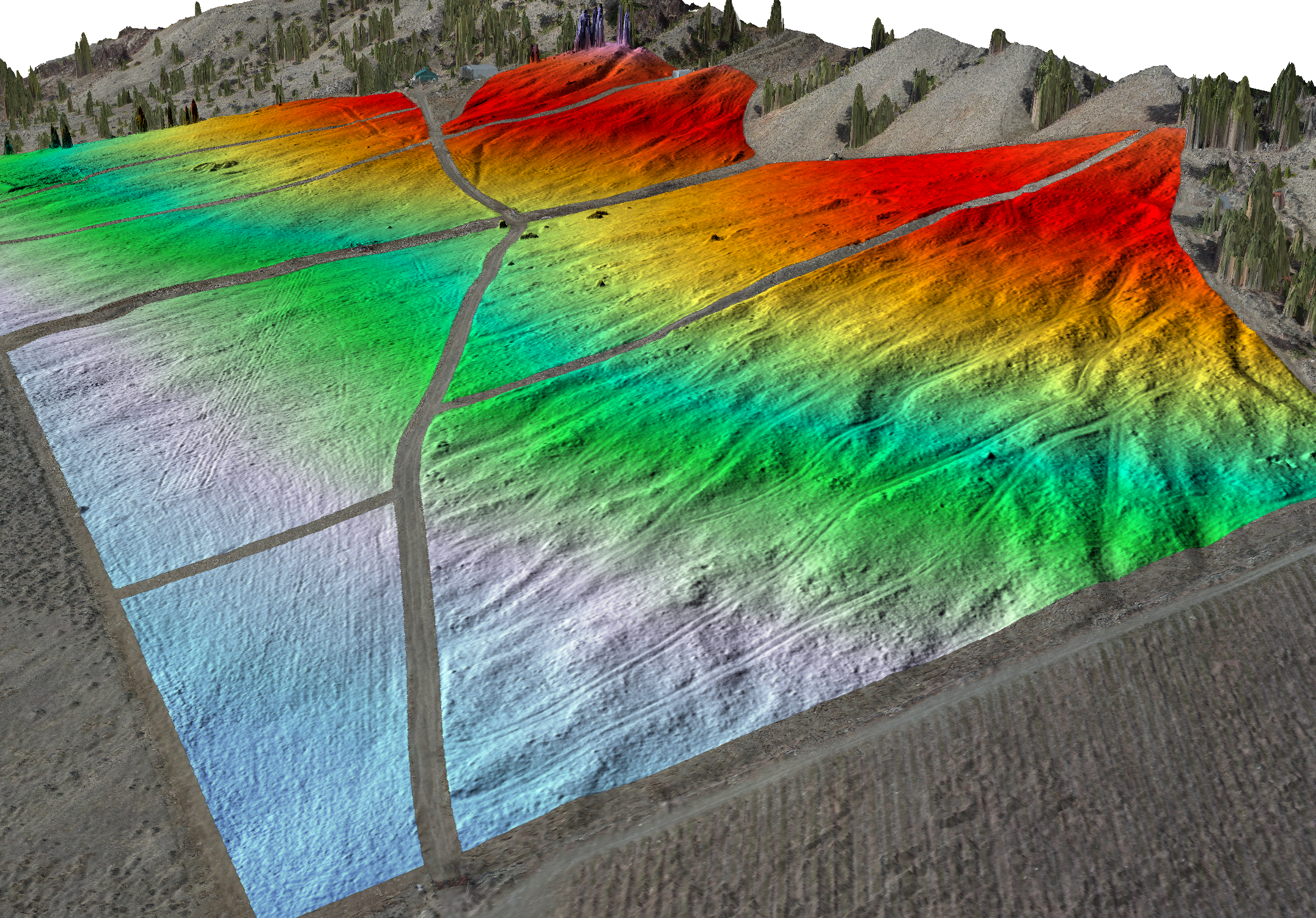
Digital Terrain Modeling
Digital Surface Models (DSMs) and Digital Terrain Models (DTMs) are fundamental products for any engineering or design project. A DSM captures the top of everything — buildings, vegetation, structures — while a DTM represents the bare-earth ground surface with all above-ground features removed.
We generate high-resolution terrain models from either LiDAR or photogrammetry data, depending on your site conditions and accuracy requirements. These models form the basis for grading design, drainage analysis, slope stability assessment, flood modeling, and volumetric calculations. Delivered as GeoTIFFs, TINs, or contour linework in your preferred format and coordinate system.
- DSM and DTM generation from LiDAR or photogrammetry
- Contour linework at custom intervals
- Slope, aspect, and hillshade analysis
- GeoTIFF, TIN, and DWG contour delivery
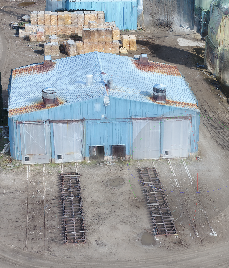
3D Modeling & BIM
Turn your project site into a photorealistic 3D digital twin. Using hundreds of overlapping aerial photographs processed through AI-enhanced photogrammetry, we create detailed 3D mesh models that capture the geometry, texture, and spatial context of your site with exceptional fidelity.
These models are invaluable for architecture and design visualization, construction progress tracking, stakeholder presentations, and BIM (Building Information Modeling) integration. We also deliver dense, colourized point clouds that can be imported directly into BIM platforms like Revit, Navisworks, and Bentley for clash detection, as-built verification, and design overlay.
- Photorealistic 3D mesh models
- Dense colourized point clouds for BIM import
- Compatible with Revit, Navisworks, Bentley, SketchUp
- Construction progress tracking over time